
“Virtual New Orleans” by Colleen
Conference:
- SIGGRAPH 1996
-
More from SIGGRAPH 1996:


Type(s):
Entry Number: 39
Title:
- Virtual New Orleans
Program Title:
- Digital Bayou
Presenter(s):
Project Affiliation:
- Planet 9 Studios
Description:
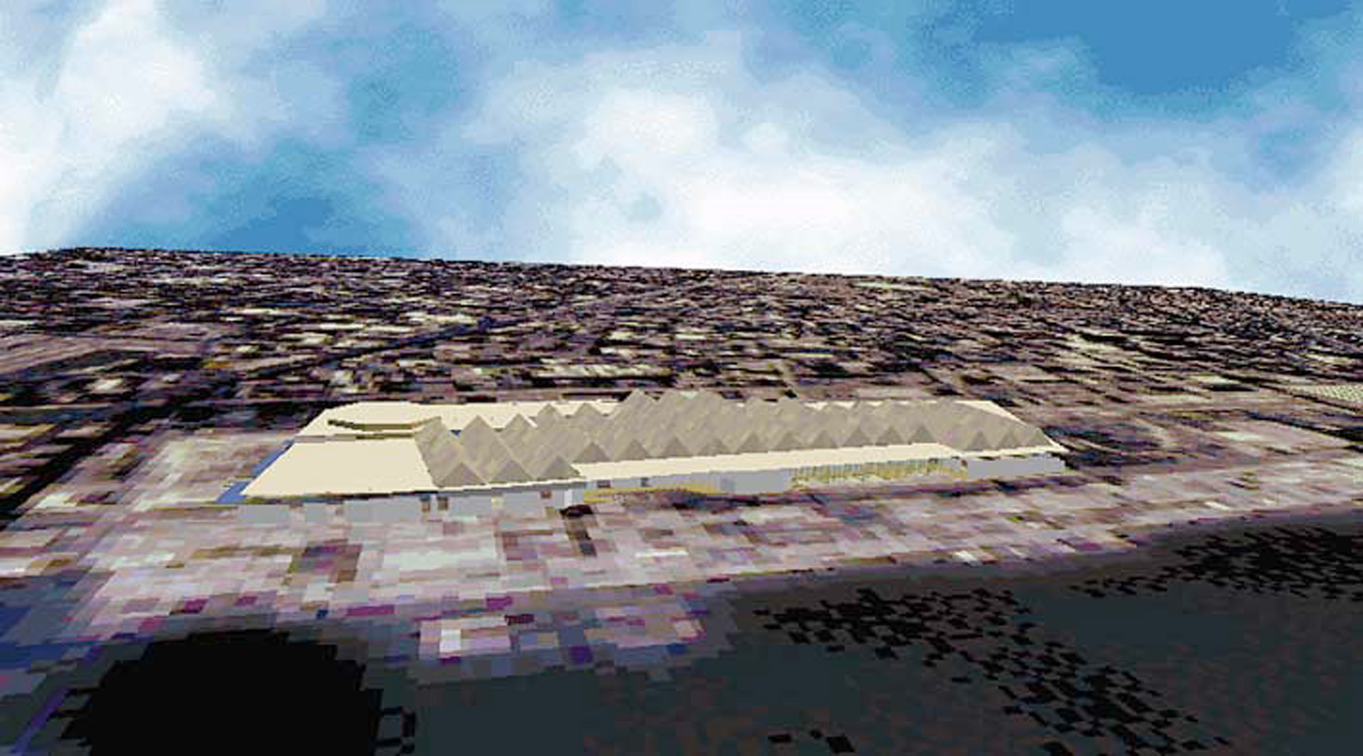
An extension of the Digital Bayou exists only on the Web: one of the first of many cities to be recreated in VRML.
Virtual New Orleans is a 3D, VRML representation of down- town New Orleans. It includes several neighborhoods, including the Waterfront, the French Quarter and the Convention Center area. In Virtual New Orleans, you can walk (or fly, if you prefer) down actual New Orleans streets. As you pass your mouse over a building, its address and company name are displayed. Each building is hyper-linked to the occupant’s Web site, if they have one. Some buildings lead to interior models of the building (try clicking on the convention center).
Virtual New Orleans’ 3D geome- try was created in AutoCad and 3D Studio. Base data came from a number of sources including city GIS mapping, high-altitude photography, and the USGS. In order to make models that transmit quickly over the Internet, polygons and texture maps were used sparingly. (Virtual New Orleans is under 5,000 polygons).
When the modeling is complete, the file is translated into a VRML format. From there, it is massaged and optimized by hand (with a generous dose of help from Intervista Software). Key buildings have photos of the actual building applied to them. The architectural photographer took pictures of the buildings, scanned the photos onto Kodak photo CDs, removed cars, trees, etc. in Photoshop, and then applied the photos to the computer model.