
“A software for reconstructing 3D-terrains from scanned maps”
Conference:
Type:
Title:
- A software for reconstructing 3D-terrains from scanned maps
Presenter(s)/Author(s):
Abstract:
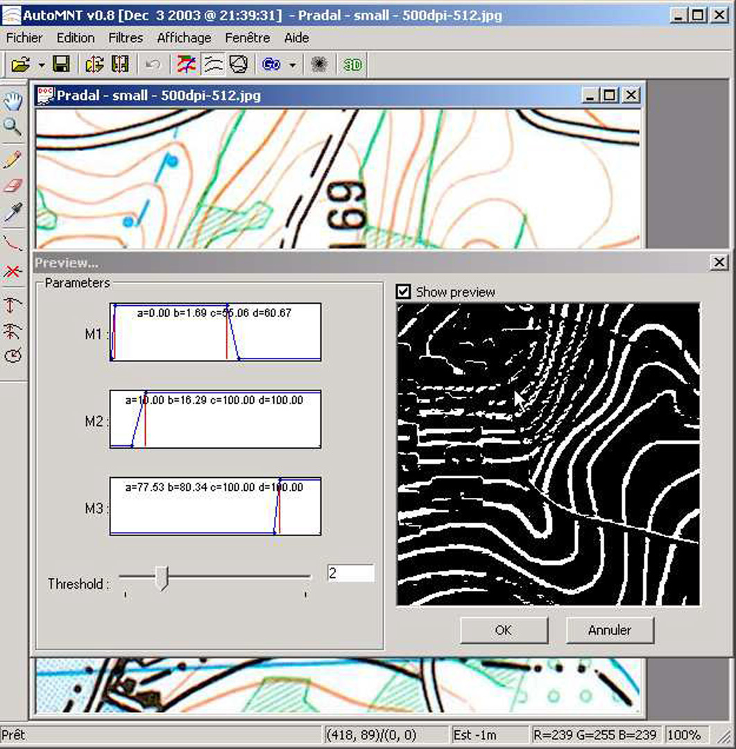
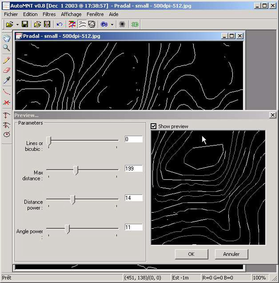
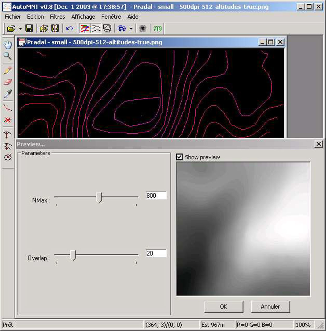
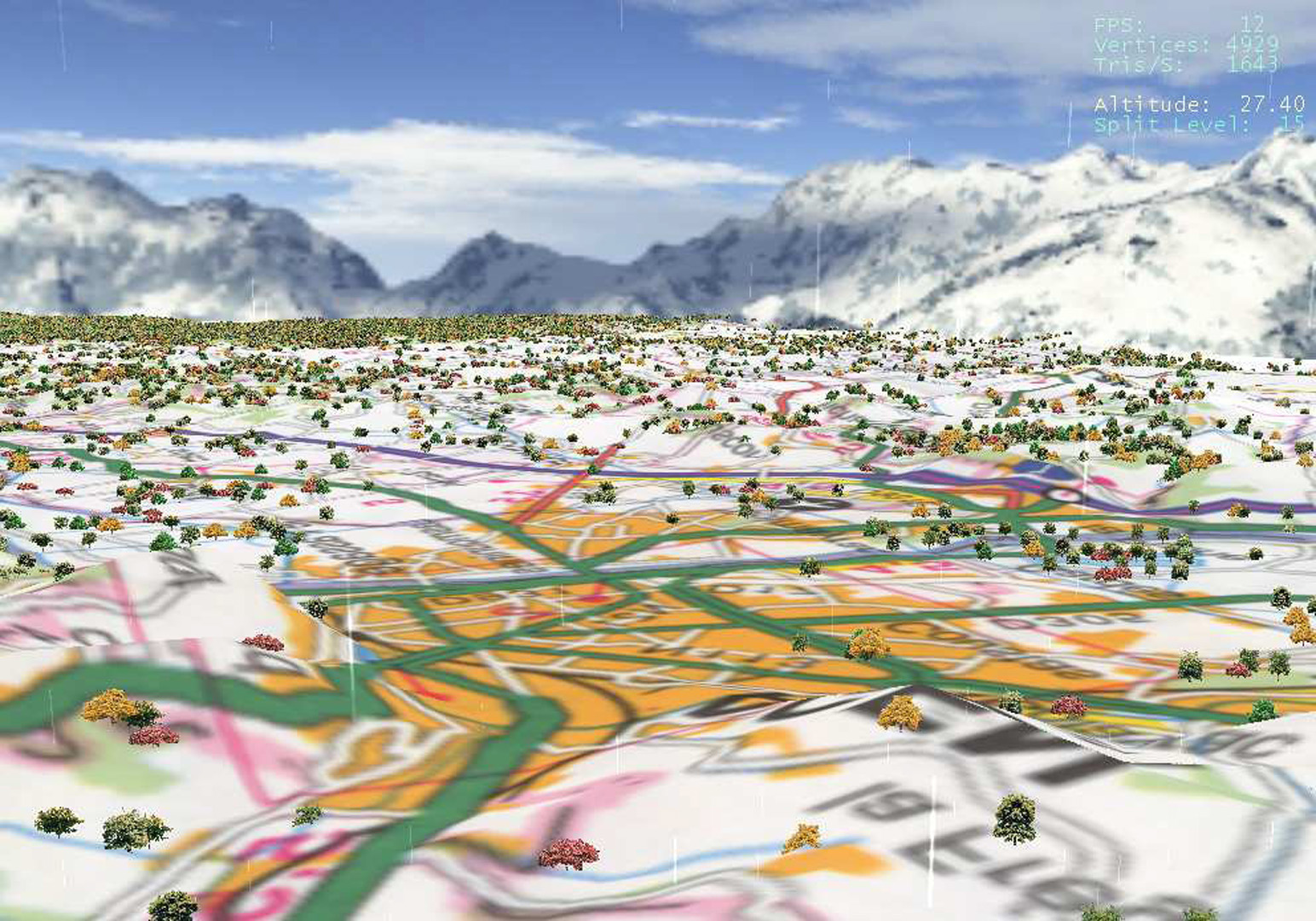
This sketch presents AutoMNT, a software designed for creating Digital Elevation Models (DEM) from scanned color topographic maps for 3D vizualisation and navigation. DEM are used in a large number of civil and military applications. Some operators like USGS in the USA or IGN in France sell DEM data files, but this represents a small database compared to available paper maps for all places over the world at different time periods. The goal is then to create DEM from scanned topographic maps in the most automatic way. Some commercial raster-to-vector softwares (like R2V, WinTOPO, etc.) include tools to help the user in this task, but they are quite limited, and many multi-layers maps need hours of painful manual interventions and corrections. [Arrighi and Soille 1999] described a method based on mathematical morphology but it only works for very clean single layer maps with contour lines only.
References:
Arrighi, P., and Soille, P. 1999. From scanned topographic maps to digital elevation models. In Proceedings of Geovision’99.
Spinello, S., and Guitton, P. 2004. Contour line recognition from scanned topographic maps. Journal of WSCG 12, 3.
Tobor, I., Reuter, P., and Schlick, C. 2004. Multiresolution reconstruction of implicit surfaces with attributes from large unorganized point sets. In Shape Modeling and Applications’04.