
“User performance under several automated approaches to changing displayed maps” by Moses and Maisano
Conference:
Type(s):
Title:
- User performance under several automated approaches to changing displayed maps
Presenter(s)/Author(s):
Abstract:
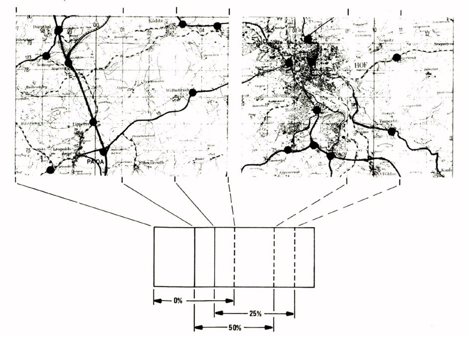
State-of-the-art computer displays seldom have sufficient resolution and size to show usable detail for a large map. One solution is to satisfy user needs by designing map display systems that present sequential map segments. The utility of two types of presentation conditions was evaluated: (a) continuous map scanning, and (b) discrete map segments using three different amounts of border overlap (0%, 25% and 50%). The task was to determine the fastest road routes between cities. A 19 in. color television monitor displayed 6×8 km map segments (1:50,000 scale) within a 60×80 km map region; participants viewed the larger map area by changing the displayed segments. Solution time, number of map segments viewed, and quality of route solutions were recorded by 24 participants on each of 12 problems divided among presentation conditions. Results showed that different presentation conditions did not significantly affect the quality of routes chosen. Problems took the least time when map segments with 50% overlap were used although 25% overlap produced similar data. Overall, the participants who changed map segments more often took less time working problems. Discrete map segments with around 25% overlap would contribute to an efficient design for a sequential map display system.
References:
1. Berman, R., and Stonebreaker, M. GEO-QUEL – A System for the manipulation and display of geographic data. SIGGRAPH ’77 Proceeding (published by Computer Graphics), 11, (1977), 186-191.
2. Carlson, E., Bennett, J., Giddings, G., and Mantey, P. The design and evalution of an interactive geo-data analysis and display system. Proceedings IFIP Congress (1974), 1057-1061.
3. Cooper, G., Moore, M., Halpin, S. MOVANAID: An analytic aid for Army intelligence processing. Proceedings, Thirteenth Annual US Army Operations Research Symposium (1974), 696-707.
4. Layman, R. S. An experimental comparison of two map display modes. Human Factors, 10(5), (1968), 497-503.
5. Moellering, H. Interactive cartographic design, American Congress on Surveying and Mapping Proceedings, (1977), 516-530.
6. Shimron, J. On learning maps. Center for Human Information Processing, UCLA San Diego (ARPA Order No. 2284), 1975.