
“Accurate Geo-Localization of Low-Altitude Overhead Images From 3D Point Clouds” by Li and Chen
Conference:
Type(s):
Title:
- Accurate Geo-Localization of Low-Altitude Overhead Images From 3D Point Clouds
Presenter(s)/Author(s):
Entry Number:
- 67
Abstract:
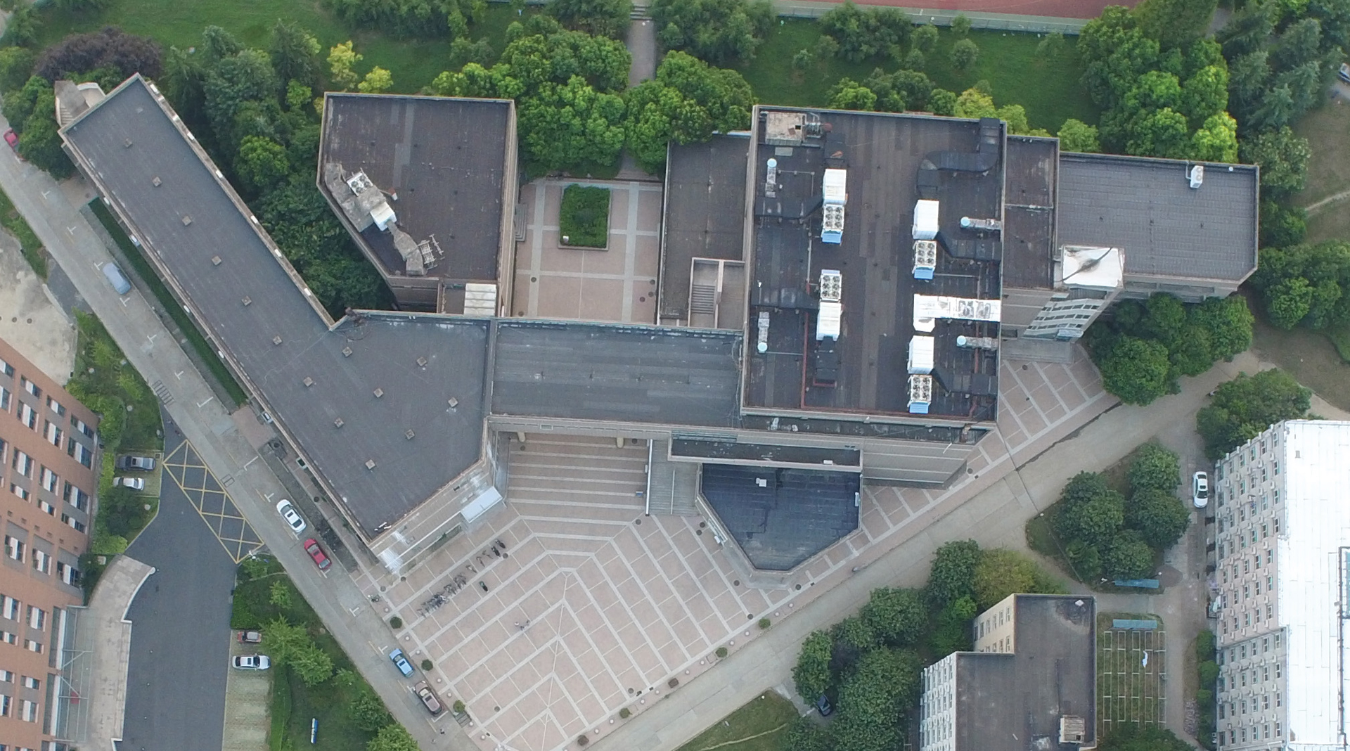
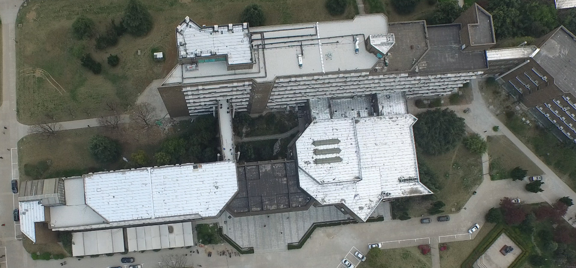
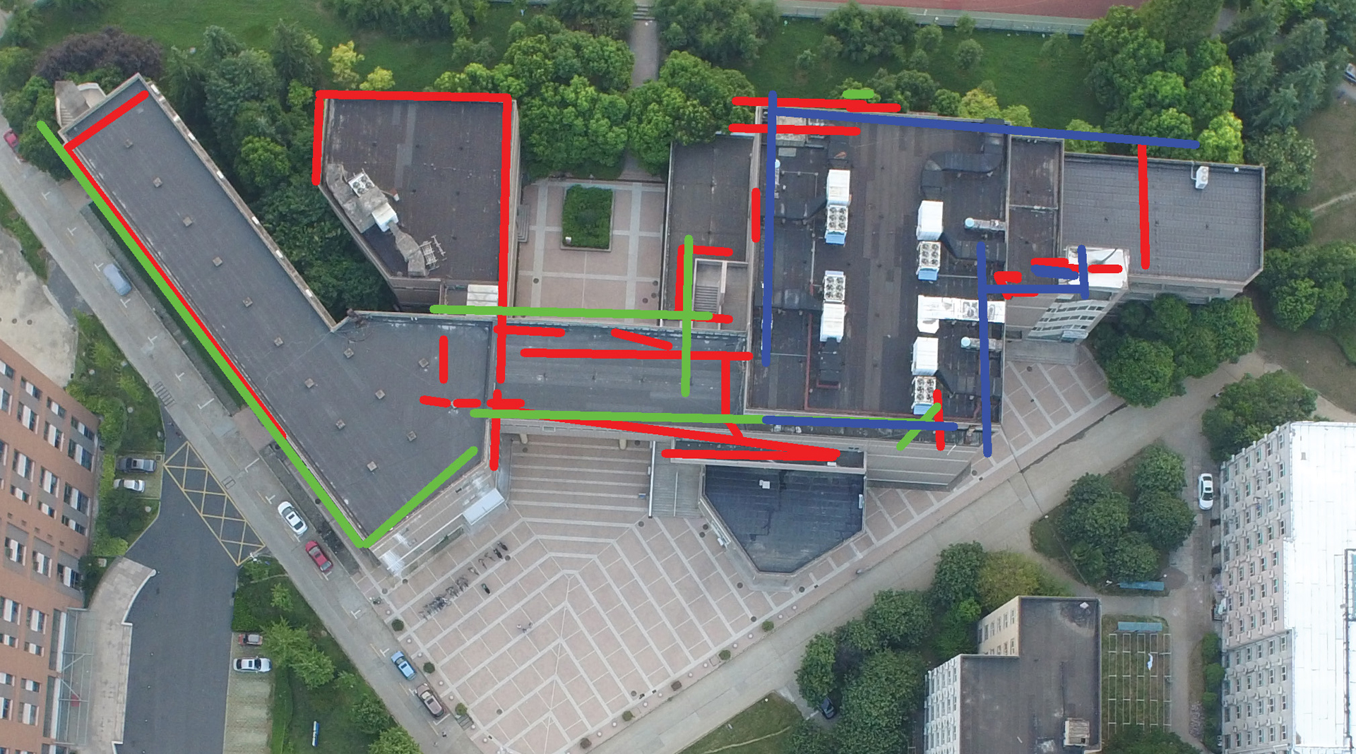
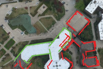
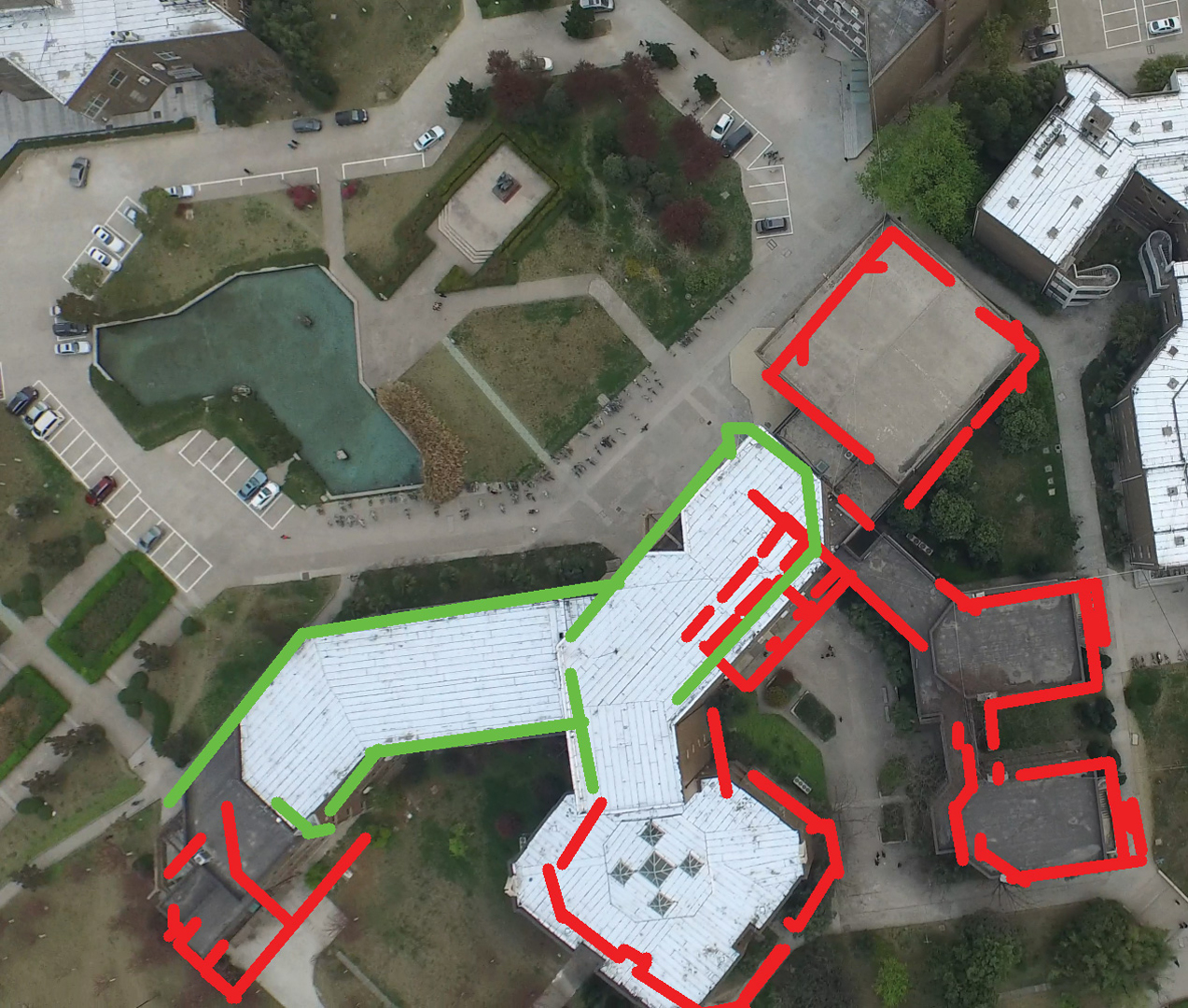
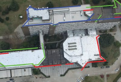
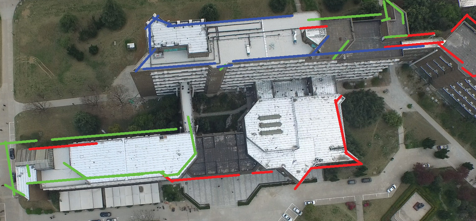
Geo-localization, aiming at aligning images with 3D models, is a key technique to many applications, such as image-based navigation, augmented reality, 3D city modeling, etc. We present a geo-localization method based on overhead images captured in low altitudes and point clouds of buildings. With two observations that 1) vertical facades of a point cloud typically correspond to edges of building roofs in the overhead image; and 2) building roofs of different altitudes are in different scales in the overhead image due to a perspective projection, we regard this geo-localization problem as a combination of a multi-layer shape matching and a global optimization of the camera pose. We test our approach on a variety of buildings with complex shapes. The experiment results demonstrate the accuracy of our geo-localization algorithm.
Keyword(s):
Additional Images:
-
- 2017 Posters: Li_Accurate Geo-Localization of Low-Altitude Overhead Images From 3D Point Clouds
-
- 2017 Posters: Li_Accurate Geo-Localization of Low-Altitude Overhead Images From 3D Point Clouds
Acknowledgements:
This project is funded by Microsoft Research Asia and partially supported by the National Natural Science Foundation of China under Nos. 61472377 and 61331017.