“A Sketching Interface for Terrain Modeling” by Watanabe and Igarashi
Conference:
Type(s):
Title:
- A Sketching Interface for Terrain Modeling
Presenter(s)/Author(s):
Entry Number:
- 073
Abstract:
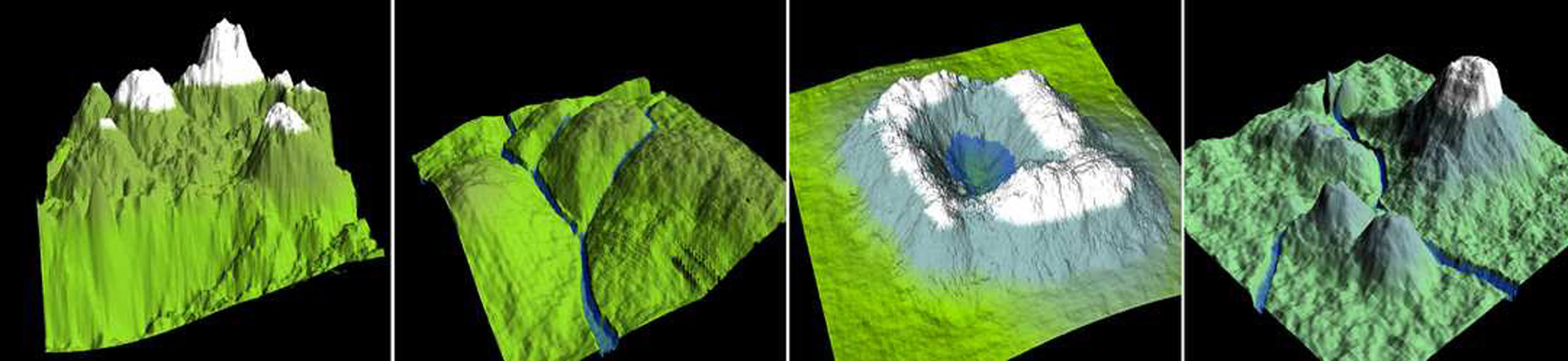
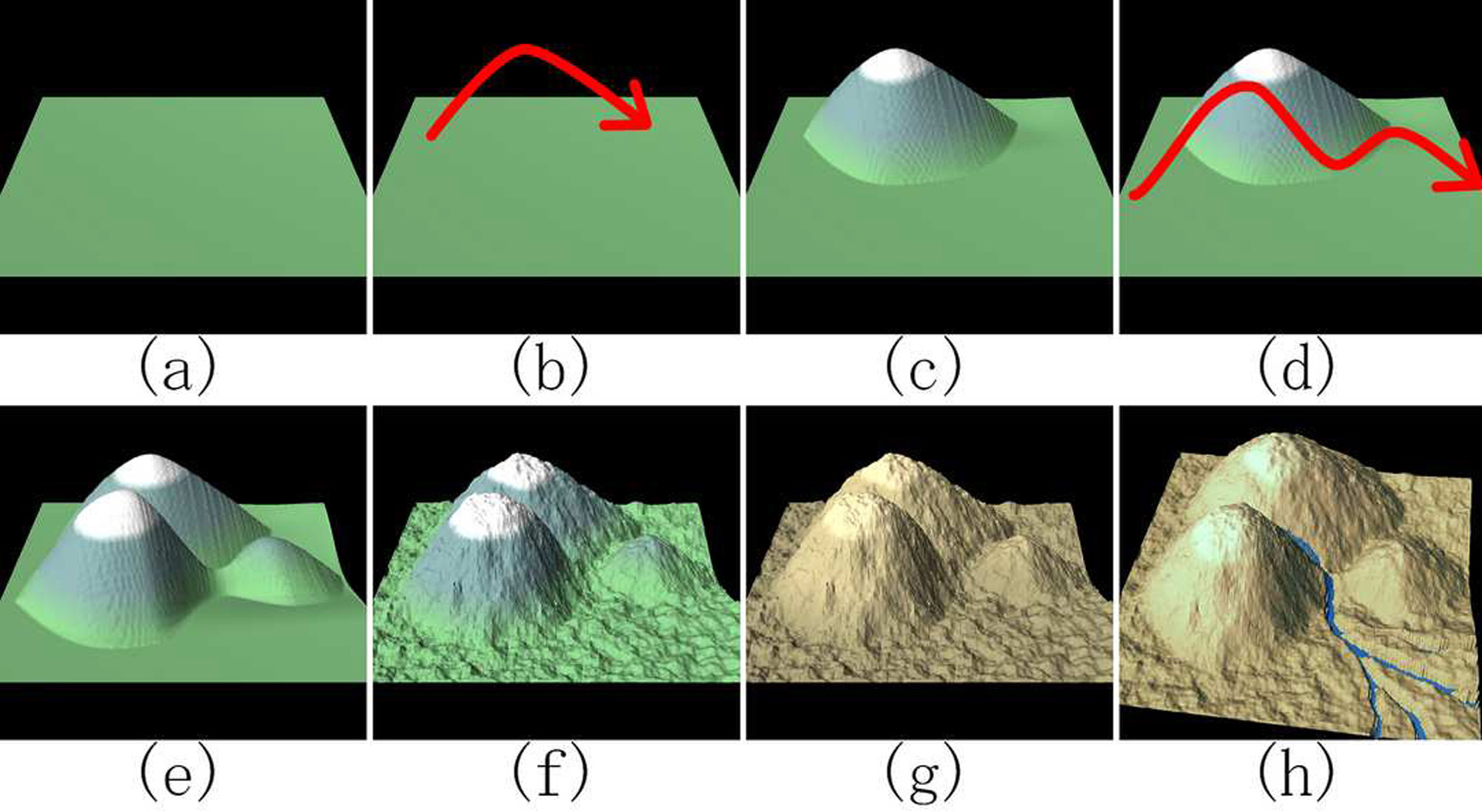
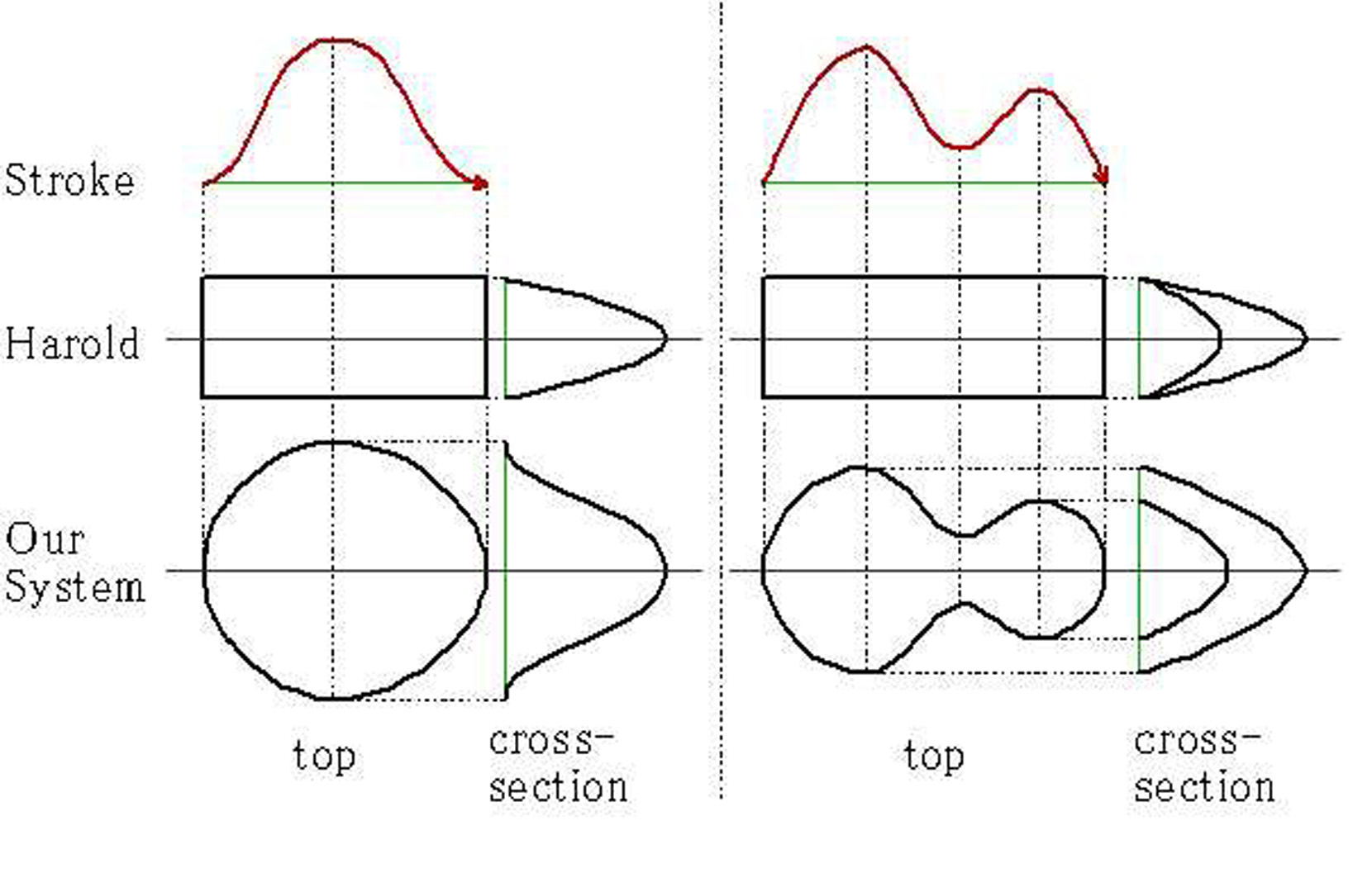
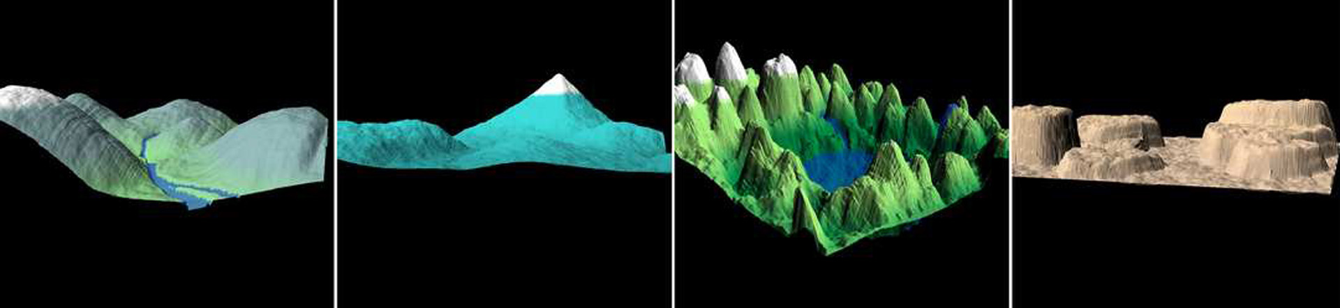
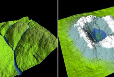
Three-dimensional terrain models are widely used in entertainment applications such as movies and video games. These terrain models are mainly used as background and it is not necessary to carefully design every detail. A popular interface for designing terrain models is standard polygonal mesh editing that explicitly manipulates 3D positions of vertices. Another popular approach is to paint 2D height eld, from which the system generates a corresponding mesh [Terragen]. These interfaces are suitable for careful design by experts, but not necessarily easy or intuitive for casual users. The Harold system [Cohen et al. 2000] included an interface where the user can directly sketch the ridgeline to design hills and mountains, but the resulting terrain looks awkward when viewed from other viewpoints.
This poster introduces a system where the user can design variety of terrain models using a sketching interface. The user edits a 3D geographical model by drawing 2D strokes that represents the desired ridgeline. Whenever a stroke is drawn, this system generates a terrain model whose ridgeline matches to the stroke on the screen.
References:
1. Cohen, J. M., Hughes, J. F., and Zeleznik, R. C. 2000. Harold: A world made of drawings. In ACM NPAR 2000, ACM NPAR.
2. Terragen#8482;. http://www.planetside.co.uk/.
Additional Images:
-
- 2004 Poster: Watanabe_A Sketching Interface for Terrain Modeling