“A screen-space approach to rendering polylines on terrain” by Ohlarik and Cozzi
Conference:
Type(s):
Title:
- A screen-space approach to rendering polylines on terrain
Presenter(s)/Author(s):
Abstract:
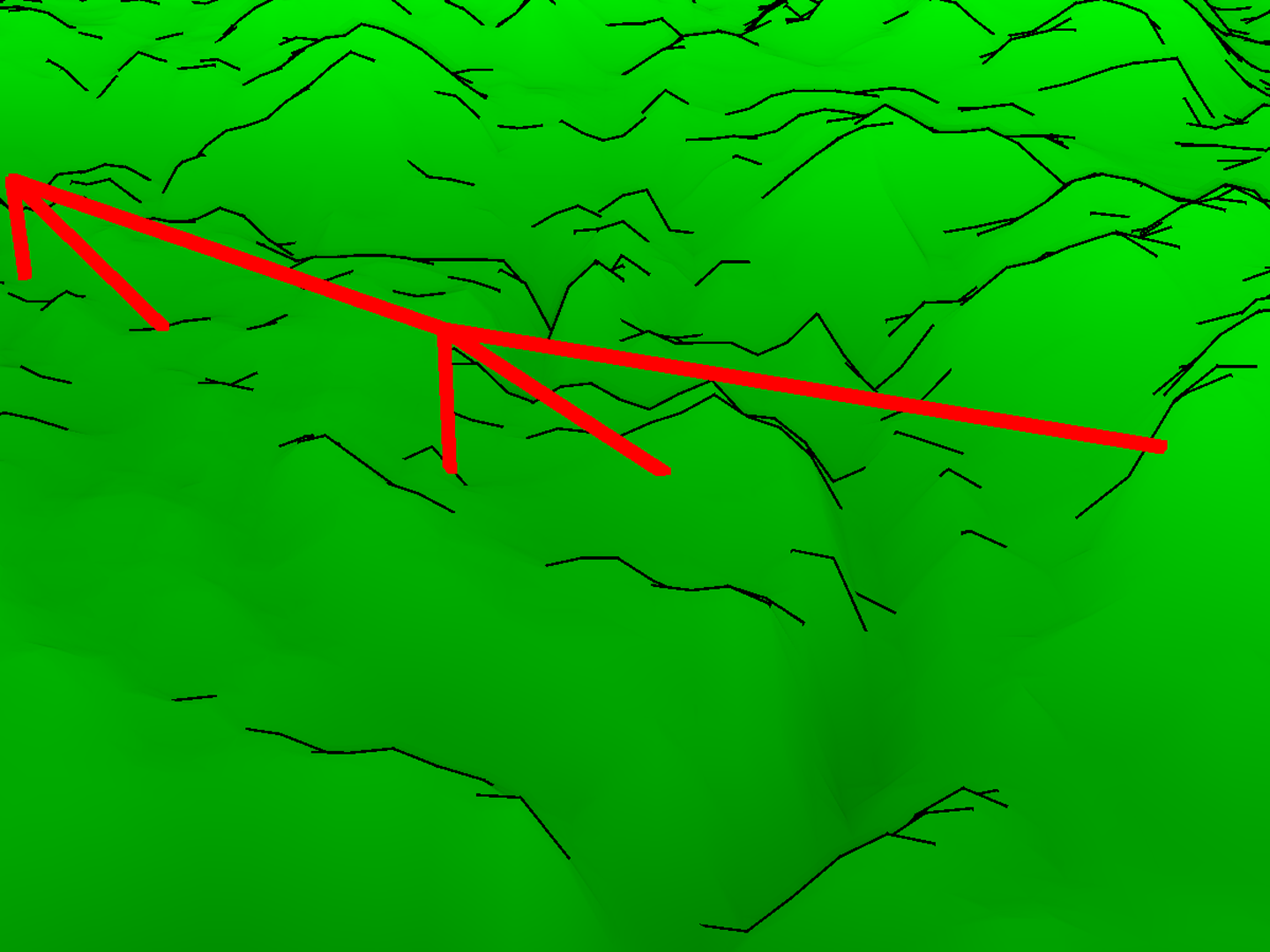
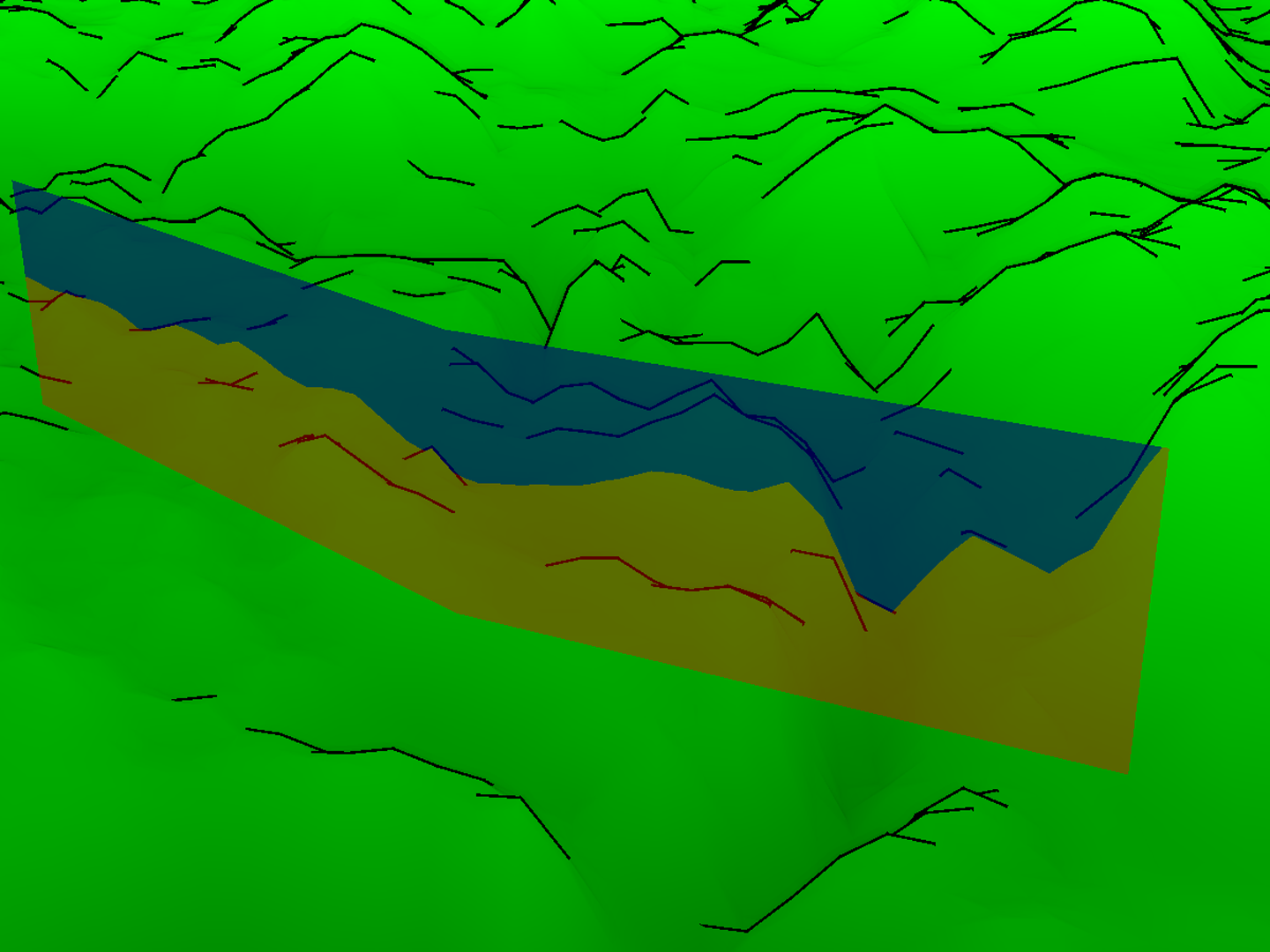
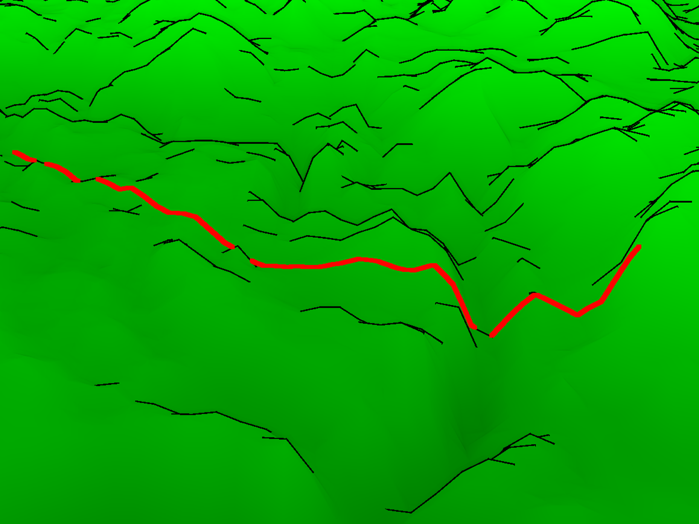
A fundamental task in virtual globe and GIS applications is to render polyline vector data representing elements such as political borders, road networks, and rivers. Rendering polylines such that they precisely drape over terrain is challenging. We present an approach that extrudes the original polyline, forming a wall, and intersects the wall with the terrain in screen-space to find the desired polyline.
References:
1. Schneider, M., and Klein, R. 2007. Efficient and accurate rendering of vector data on virtual landscapes. Journal of WSCG 15, 1–3 (January), 59–64.
2. Wartell, Z., Kang, E., Wasilewski, T., Ribarsky, W., and Faust, N. 2003. Rendering vector data over global, multi-resolution 3D terrain. In Proceedings of the symposium on data visualisation 2003, Eurographics Association, Aire-la-Ville, Switzerland, Switzerland, VISSYM ’03, 213–222.
Additional Images: