“A resolution reduction method for multi-resolution terrain maps” by Akagi, Anada, Koka, Nakayama, Nomaki, et al. …

Conference:
Type(s):
Title:
- A resolution reduction method for multi-resolution terrain maps
Presenter(s)/Author(s):
Abstract:
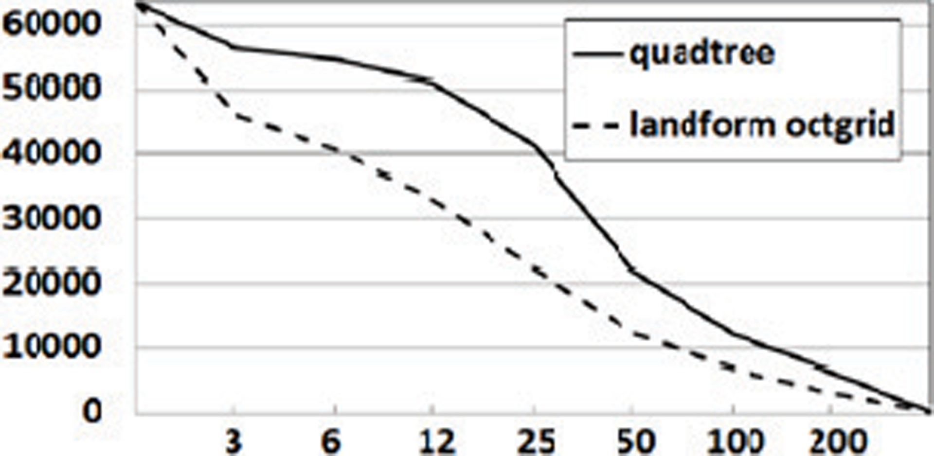
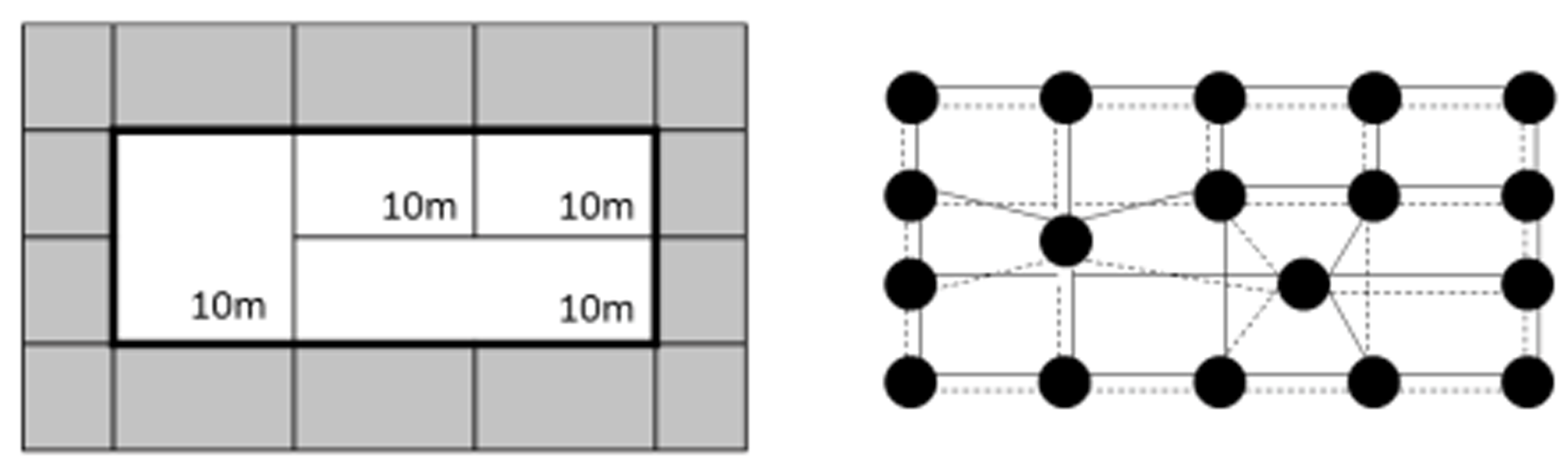
Raster images such as raster terrain maps are commonly used in computer graphics. For rapid processing such as rendering and rapid feature extraction, rapid resolution reduction methods are required that keep the quality of huge images. This study deals with the resolution reduction methods.
References:
1. Akagi, G., Motohashi, T., Nomaki, K., Tsuchida, K., and Yaku, T., Octal Graph Representation for Multi-Resolution 3D Landform Maps, SIAM Conf. GD 05, CP14, Oct. 2005. http://meetings.siam.org/sess/dsp_talk.cfm?p=17773.
2. Finkel, R. A., and Bentley, J. L., Quad trees: A Data Structure for Retrieval on Composite Keys, Acta Inf. 4:1–9, 1974.
3. Kirishima, T., Motohashi, T., Tsuchida, K., and Yaku, T., Table Processing based on Attribute Graphs, Proc. 6th IASTED Internat. Conf. Soft. Engin. & Appl., 317–322, 2002.
4. Kozminsky, K., and Kinnen, E., Rectangular Duals of Planar Graphs, Networks 15, 145–157, 1985.
5. Shindo, Y., Anada, K., and Yaku, T., Representation of Geometric Objects with Octgrids, Submitted, 2012.
Additional Images: