
“Towers in the Tempest” by Shirah
Conference:
- SIGGRAPH 2008 More animation videos from SIGGRAPH 2008:


SIGGRAPH Video Review:
Track:
- 04
Title:
- Towers in the Tempest
Length:
- 4:18
Director(s):
Company / Institution / Agency:
- GST – NASA/Goddard Space Flight Center
Description:
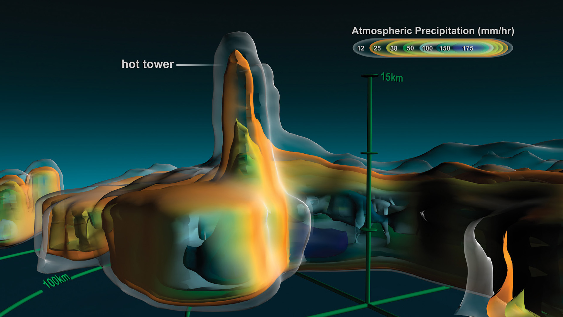
“Towers in the Tempest” communicates recent scientific research into how hurricanes intensify. This intensification can be caused by a phenomenon called a “hot tower.” For the first time, research meteorologists have run complex atmospheric simulations at a very fine temporal resolution of three minutes. Combining this simulation data with satellite observations enables detailed study of “hot towers.”
The science of “hot towers” is described using satellite observation data, conceptual illustrations, and volumetric atmospheric simulation data. The movie shows a “hot tower” observed by NASA’s Tropical Rainfall Measuring Mission spacecraft’s three-dimensional precip-itation radar data of Hurricane Bonnie. The dynamics of a hurricane and the formation of “hot towers” are briefly explained using conceptual illustrations. Volumetric cloud, wind, and vorticity data from a supercomputer simulation of Hurricane Bonnie are shown using volume techniques such as ray marching.
Additional Contributors:
Producer: Horace Mitchell
NASA/GSFC–Scientific Visualization Studio
Visualizers: Lori Perkins, Greg Shirah, Alex Kekesi, James W. Williams, Horace Mitchell, Marte Newcombe, Randall Jones, Tom Bridgman, Cindy Starr, Helen-Nicole Kostis
Science Advisor: Scott Braun
Video Editor: Stuart Snodgrass
Narrator: Horace Mitchell
System Support: Kevin Mahoney
Audio Engineer: Mike Velle
Web Support: Joycelyn Thomson Jones
Music: “Deep Realms,” The Music Bakery Publishing (BMI)
Sources: TRMM Precipitation Radar and Visible and Infrared Sensor data courtesy of the Tropical Rainfall Measuring Mission (TRMM), NASA JAXA
Hurricane simulation data courtesy of Scott Braun, NASA/GSFC, based on the Pennsylvania State University/ National Center for Atmospheric Research MM5 model
Spacecraft ephemeris data courtesy of space-track.org Blue Marble MODIS earth data composite courtesy
of the MODIS Science Team NASA/GSFC and NASA’s Earth Observatory Reto Stockli SSAI Inc.