
“LRO Scouts for Safe Landing Sites – Stereoscopic Version” by USRA – NASA/Goddard Space Flight Center
Title:
- LRO Scouts for Safe Landing Sites - Stereoscopic Version
Conference:
SIGGRAPH Video Review:
Description:
The Lunar Reconnaissance Orbiter (LRO) is NASA’s scouting mission to prepare for a return to the moon by 2020. Armed with multiple instruments, LRO collects data to assess the lunar terrain in search of safe landing sites for future missions. This stereoscopic visualization demonstrates how LRO uses its instruments collectively to accomplish its objective.
As a first step, LRO’s Lunar Orbiter Laser Altimeter (LOLA) instrument assesses the lunar topography, calculating the height, slope, and roughness of the lunar terrain. From this topographic data, level surface areas can be derived as the most basic requirement of safe landing sites.
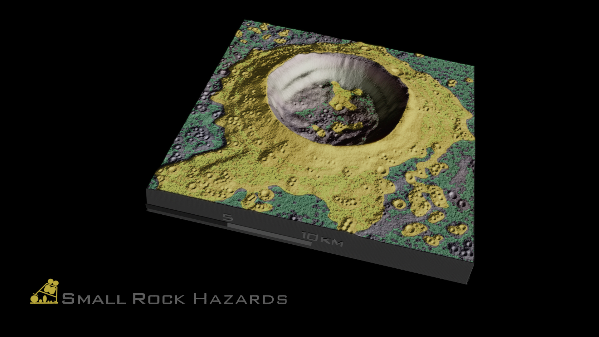
Next, an example thermal map of the lunar surface is revealed to show the sort of data the Diviner Lunar Radiometer Experiment (DLRE) collects. Understanding changes in surface temperature helps to determine small rock hazards, since they retain and release heat at a different rate than the surrounding regolith structures. Finally, large rock hazards can be found with the Lunar Reconnaissance Orbiter Camera’s (LROC) high-resolution surface imagery. Removing all rock-hazard areas from level surface areas reveals potential safe landing sites for future manned and robotic missions to the moon.
Software:
Maya, RenderMan Custom shaders, MEL scripts, Electro, Lightwave 3D, After Effects, Final Cut Pro
Additional Contributors:
Created by: Scientific Visualization Studio & Goddard Television Production (NASA/GSFC)
Stereoscopic Production & Editing by: Helen-Nicole Kostis
Monoscopic Production & Editing by: Andrew Freeberg
Stereoscopic Lead Animators: Helen-Nicole Kostis, Chris Meaney
Monoscopic Lead Animators: Alex Kekesi, Chris Meaney
Science Advisors: John Keller, Rich Vondrak, Craig Tooley, Kristina Safdie, Bill Sluder
Written by: Bill Steigerwald, Andrew Freeberg
Narration by: Erica Drezek
Music: “Fantastic Voyage” Bruce H. Zimmerman, composer (ASCAP) Published by Pretty Linda (ASCAP) American Music Company, Inc.
Camera Rig Visualization Support: Greg Shirah
Contributors: Tom Bridgman, Walt Feimer, Randall Jones, Alex Kekesi, Horace Mitchell, Lori Perkins, Trent L. Schindler, Greg Shirah, Eric Sokolowsky, Michael Starobin, Chris Smith, Cindy Starr, Joycelyn Thomson-Jones, Victoria Weeks, James W. Williams, Ernest Wright
Special Thanks: Wade Sisler, Jay Friedlander, Lora Bleacher