
“Coal Fire Research. A Sino-German Initiative” by German Remote Sensing Data Center
Title:
- Coal Fire Research. A Sino-German Initiative
Conference:
SIGGRAPH Video Review:
Director(s):
Company / Institution / Agency:
- German Remote Sensing Data Center
Description:
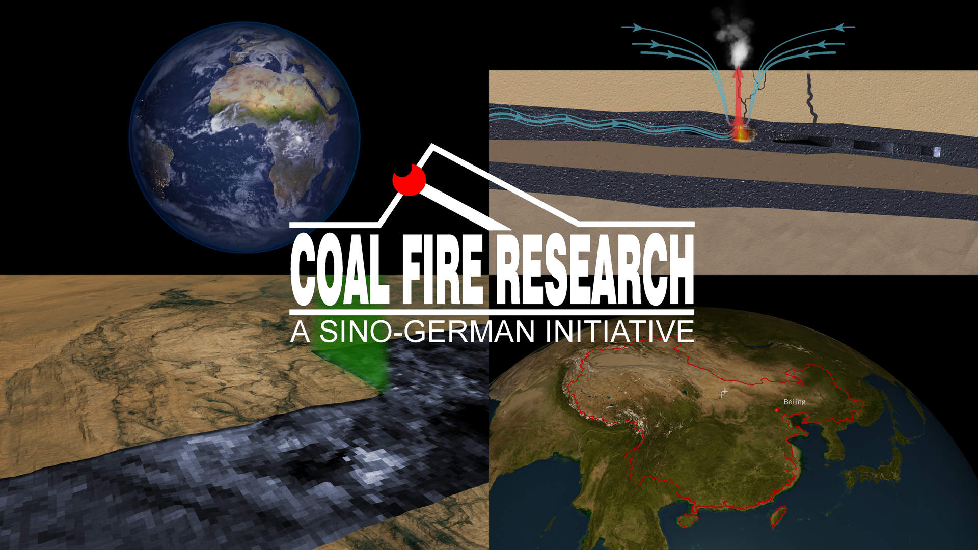
Satellites observe our planet day and night, making visible what is unseen to the naked eye (for example, the CO2 concentration in the atmosphere). Within the last 200 years, the CO2 level has grown by 25 percent, a major reason for the greenhouse effect and global warming.
One source of CO2 hasn’t gained much atten-tion yet. All around the world, coal fires are burning under the soil: in North America and Australia for centuries, in South Africa, Indo-nesia, or India for decades. The problem is worst in China, where more than 100 sites are on fire all the time.
A Sino-German research project, with assis-tance from the German Aerospace Center, is working on detection of coal fires.
This animation focuses on these coal-fire emissions. After an introduction to the CO2 problem, it summarizes coal fires in China and their ignition, development, and effects. The final part of the animation describes detection of coal fires by analyzing heat patterns in sat-ellite images.
Hardware:
Render farm containing 15 PCs, each with Dual Intel XEON 3.0 GHz CPU, 2GB RAM
Software:
Visual Nature Studio
3ds Max
Combustion
Adobe After Effects
Adobe Premiere
Adobe Photoshop
PCI Geomatica
ESRI ArcView
Additional Contributors:
Director: Nils Sparwasser
Contributors: Nils Sparwasser, Thorsten Andresen, Christian Gredel, Stephan Reiniger, Robert Meisner
Producers: GeoVisualization Center, German Remote Sensing Data Center, German Aerospace Center