
“Antarctica: A Flying Tour of the Frozen Continent” by NASA Scientific Visualization Studio
Conference:
- SIGGRAPH 2001 More animation videos from SIGGRAPH 2001:


SIGGRAPH Video Review:
Track:
- 35
Title:
- Antarctica: A Flying Tour of the Frozen Continent
Length:
- 4:59
Director(s):
Company / Institution / Agency:
- NASA Scientific Visualization Studio
Description:
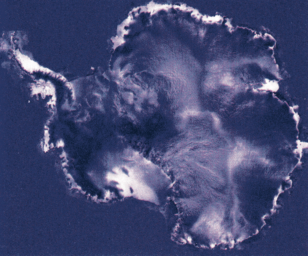
For 18 days during the southern hemisphere spring of 1997, a NASA-launched Canadian satellite called RADARSAT collected pieces of a puzzle that will help scientists study the most remote and inaccessible area on earth: Antarctica. Scientists have now put the puzzle pieces together to form the first high-resolution radar map of the mysterious frozen continent. This new map has answered scientist’s questions about Antarctica and raised new questions about strange and fascinating features never seen before.
Additional Contributors:
Producer: NASA/GSFC – SCIENTIFIC VISUALIZATION STUDIO
Contributors: KEN JEZEK, MARTE NEWCOMBE, STU SNODGRASS, WADE SISLER, MICHAEL STAROBIN, HORACE MITCHELL