
“Vectorization of gridded urban land use data” by Sexton and Watson
Conference:
Type(s):
Title:
- Vectorization of gridded urban land use data
Presenter(s)/Author(s):
Abstract:
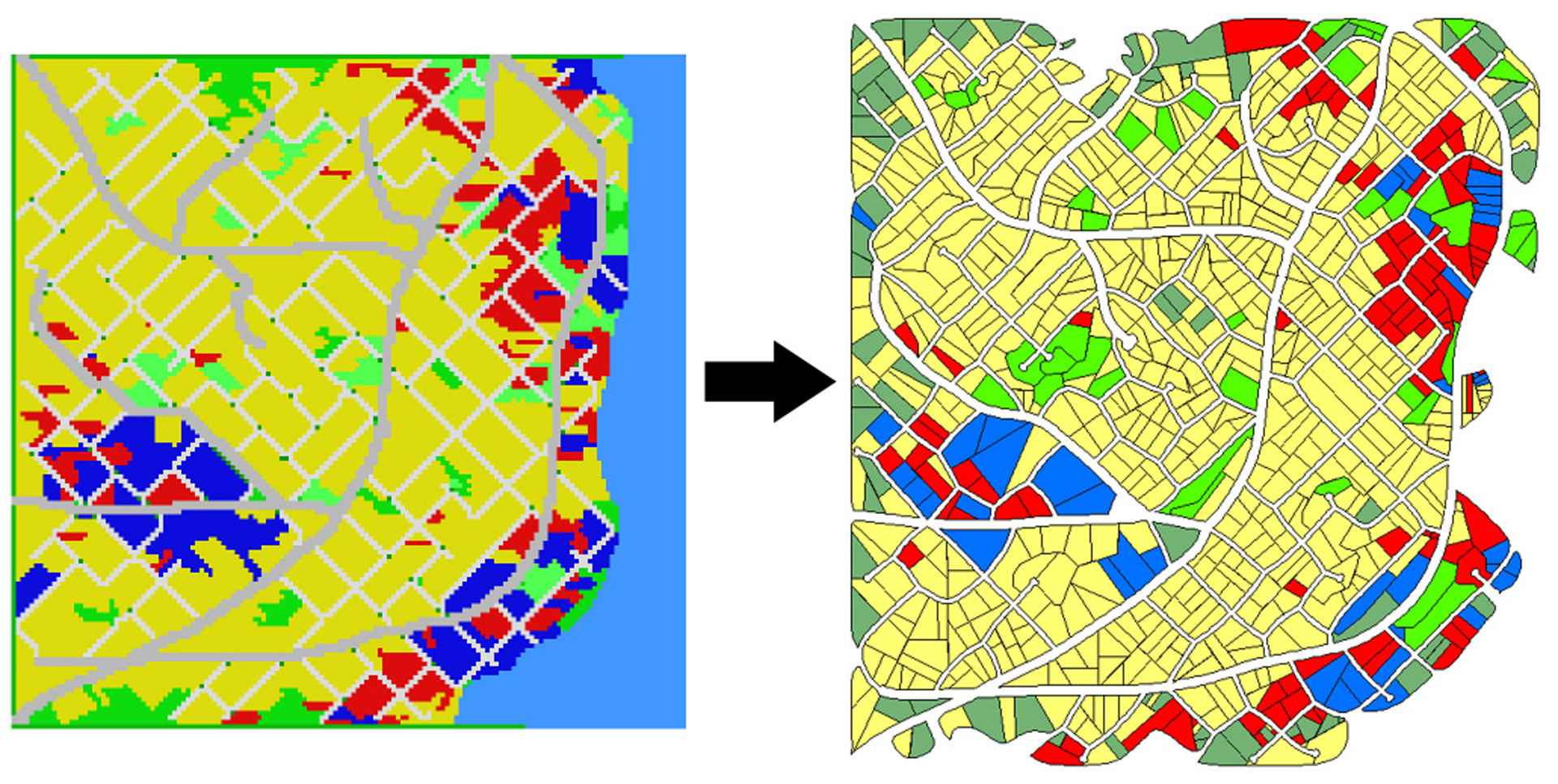
In the digital entertainment industry, cities are one of the largest artifacts modeled by artists. One alternative to modeling an entire city by hand is to use an urban simulation. Often, those simulations use a gridded terrain representation. Translating gridded simulation results into a more continuous, realistic representation can often be difficult. Our vectorization process transforms gridded urban land use data into a representation that mimics what might be seen in GIS or online mapping tools.
References:
1. Parish, Y. I. H., and Müller, P. 2001. Procedural modeling of cities. In Proc. SIGGRAPH 2001, 301–308.
2. Zhang, T. Y., and Suen, C. Y. 1984. A fast parallel algorithm for thinning digital patterns. Commun. ACM 27, 3, 236–239.
ACM Digital Library Publication:
Overview Page:
Submit a story:
If you would like to submit a story about this presentation, please contact us: historyarchives@siggraph.org