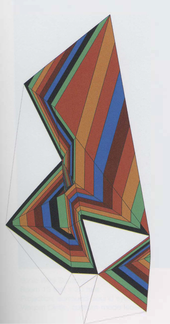
Jan Piribeck: Contour Tin
Artist(s):
Title:
- Contour Tin
Exhibition:
Creation Year:
- 2005
Medium:
- Inkjet print
Size:
- 14 inches x 20 inches
Category:
Artist Statement:
For close to six years, I have been acquainting myself with GIS (Geographic Information Systems) and have utilized this medium in tandem with other digital imaging systems to chart the geography of physical and psychological space. The GIS components include people and methodologies as well as the hardware and software devices used to combine and generate data and visual displays. This image is a map that gives form to the aesthetic preferenes of a group of people that I selected to do a visual survey of my neighborhood in Portland, Maine. While the subject matter is local, the project has relevance in the larger context of exploring the role of art, aesthetics, and creativity in community development. The map is part of a series of small-scale mutltiples that reflect my concern with visual cognition; I am interested in creating images that serve to illustrate or embody thought patterns and processes. Influences on my thinking and creative work include the writings of Theosophists Annie Besant and C.W. Leadbeater, who in 1901 published the book, Thought Forms, which addressed the power of thought and its manifestation as visible form. I am also very interested in the blackboard drawings of Rudolf Steiner and Joseph Beuys, which were a means of visualizing ideas about art and other subjects. Beuys once stated: “Everyone is an artist,” which is a concept central to my project. While I am trained in the tradition of making authentic forms in relationship to a specific medium (painting) and a primary discipline (visual art), my current interests lead me toward producing visual forms that can be co-authored or replicated by individuals other than myself. GIS has to do with spatial analysis and awareness, and has the capacity to create a better understanding and appreciation of both the natural and the built environment. My intention is to make maps of individual and societal perceptions, views and opinions, which serve to both unite and separate human beings from one another. Many contemporary artists are incorporating elements of GIS into their work, such as spatial coordinates, digital maps, and remote-sensing images. I am very interested in the full aesthetic impact of this medium, and more specifically I’m interested in using it to address issues related to cultural and environmental sustainability .


