“Atlas supplement to the 1972 County and City Data Book” by Tedrow and Hoerauf
Conference:
Type(s):
Title:
- Atlas supplement to the 1972 County and City Data Book
Presenter(s)/Author(s):
Abstract:
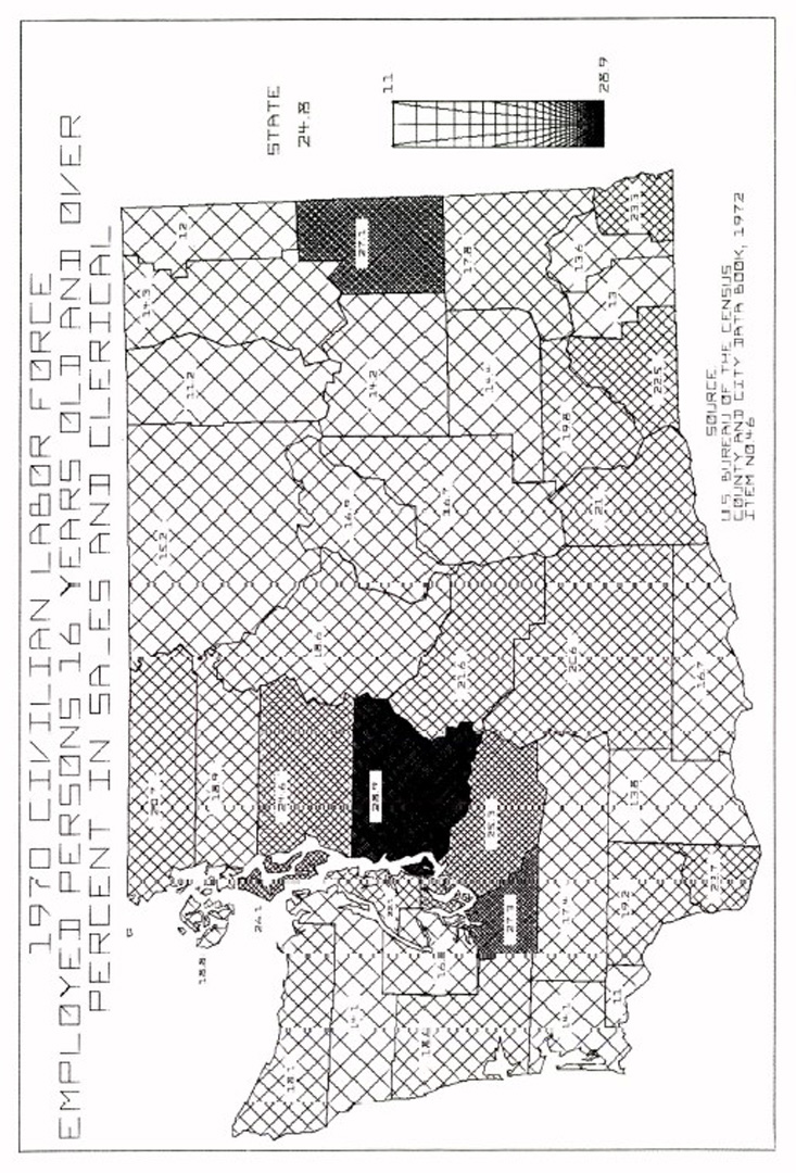
A series of maps presenting the spatial distribution of the tabular data from the 1972 County and City Data Book is discussed. Using an automated mapping procedure developed on a minicomputer by two non-computer scientists, 196 choropleth maps of county-level data for the State of Washington were prepared. The maps provide governmental decision-makers and planners a means to quickly comprehend patterns in the data that are not readily noticeable in the tabular presentation of the data.
References:
1. Dalton, J., Billingsley, J., Quann, J., and Bracken, P. “Interactive Color Map Displays of Domestic Information.” SIGRAPH-ACM Computer Graphics, 13(2), (1979), pp. 226-233.
2. Jenks, G. F. and Caspall, F. C. “Error on Choropleth Maps: Definition, Measurement, Reduction.” Annals of the Association of American Geographers, 61, (1971), pp. 217-44.
3. Schmid, Calvin F. and Schmid, S. E. Handbook of Graphic Presentation (Second Edition), Ronald Press Company, New York, (1979).
4. Tedrow, Lucky M. and Hoerauf, E. Washington County Atlas Supplement to the County and City Data Book, 1972. In press, Western Washington University, (1980).
5. Tobler, W. R. “Choropleth Maps Without Class Intervals?”, Geographical Analysis, 5, (1973), pp. 262-5.
6. United States Bureau of the Census. County and City Data Book, 1972. (A Statistical Abstract Supplement). Washington, D. C.: U.S. Government Printing Office, (1973).
7. United States Bureau of the Census. County and City Data Book, 1977. (A Statistical Abstract Supplement). Washington, D. C.: U.S. Government Printing Office, (1978).
8. United States Bureau of the Census and Man-power Administration. Urban Atlas. Washington, D. C.: U.S. Government Printing Office, (1974).


