
“Moving Mountains: Using Interactive Graphics to Teach Geography” by Seaver
Conference:
Type:
Title:
- Moving Mountains: Using Interactive Graphics to Teach Geography
Presenter(s)/Author(s):
Abstract:
This presentation explores the Science Museum of Minnesota’s approach to informal science learning by focusing on how its classroom students and visitors to one of its Web sites, The Greatest Places Online, are developing interactive simulations to learn geography and sciences related to geography. The Greatest Places Online is an educational resource that complements the Science Museum’s latest large-format film on geography for Omni-theaters, entitled The Greatest Places. The film, which debuted in February of 1998, features seven diverse geographical locations: the Amazon Basin, Greenland, Iguazu Falls in Argentina, Madagascar, the Okavango Delta in Botswana, and the Chang Tang plateau of Tibet.
In Moving Mountains, attendees have the opportunity to view several examples of multimedia projects created by students and educators from the museum for The Greatest Places Online. Many of these projects are based on construction kits whose geographical settings come from the seven places featured in the Greatest Places film. They are created using the award-winning and innovative authoring software for kids, MicroWorlds (from LCSI), where graphics, video, and sound can be brought together interactively through a simplified version of the LOGO programming language. Completed projects can be viewed through a free player that can be downloaded from the Greatest Places Web site; there is also a beta version plug-in available to view games directly from the Internet.
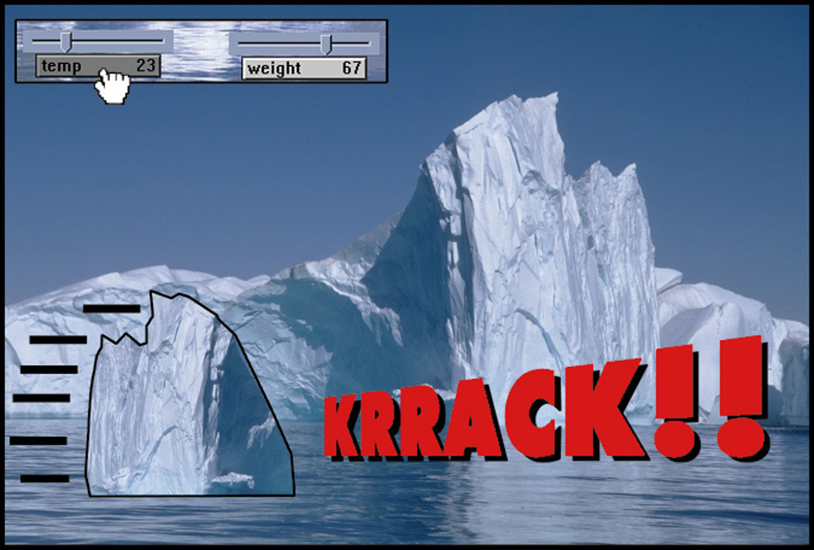
We believe the interactive graphics approach demonstrated through The Greatest Places Online could prove effective in classroom and home settings as well. For example, to help students understand weather systems, a geography teacher might want to teach iceberg formation as a tie-in to the Greatest Places film. After visiting the Greatest Places Online, this teacher, whose institution already owns MicroWorlds, might suggest class interactivity to help in understanding how an iceberg is formed. Students could download a basic MicroWorlds kit from the Web site, which includes a background and several “costumes” that can be attached to moveable turtles (sprites) on the screen. A variable slider that changes temperature or snowfall directly affects whether an iceberg separates from the larger ice mass. Once the iceberg separates, the movement is animated. Several icebergs can be calved and moving on the screen at the same time. When they hit each other, they bounce away. Time might also be a variable, where the iceberg slowly melts. This process can also be animated.