
“A Car-navigation System based on Augmented Reality” by Sawano and Okada
Conference:
Type(s):
Title:
- A Car-navigation System based on Augmented Reality
Session/Category Title: Augmented and Virtual Reality
Presenter(s)/Author(s):
Abstract:
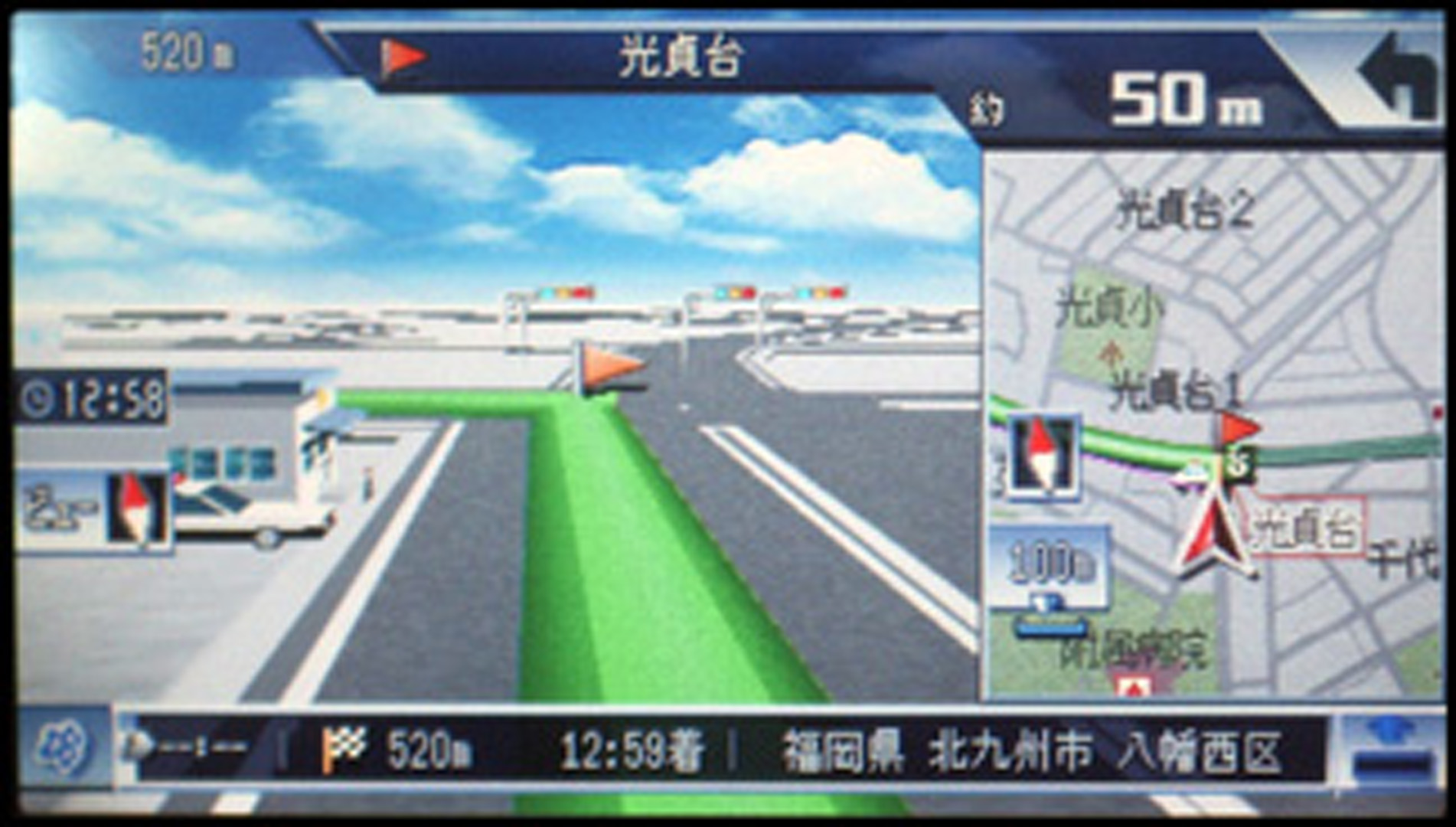
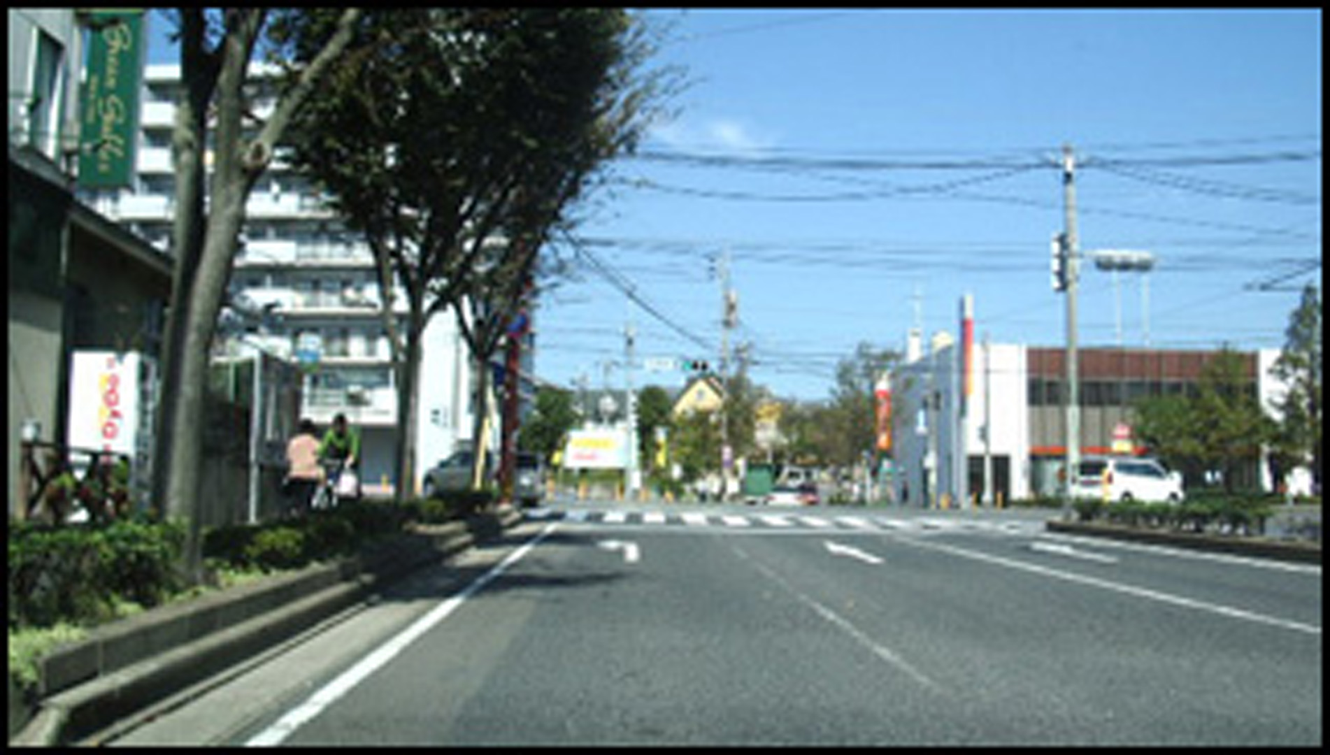
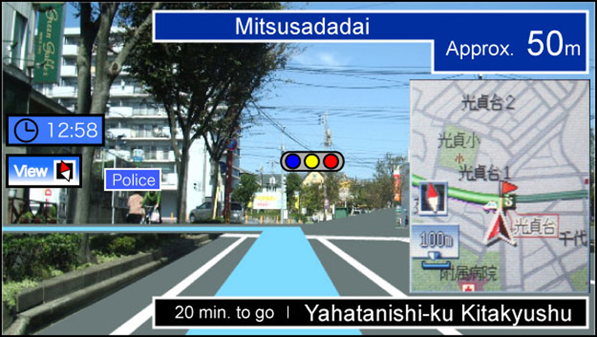
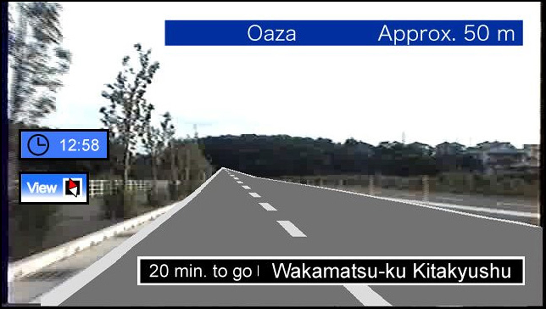
In this sketch we propose a display method for car-navigation systems based on an Augmented Reality (AR) technique. Car- navigation systems, as shown in Fig. 1, based on three-dimensional Computer Graphics (3D-CG) techniques with a digital map and GPS are widely used. However, if the digital map is not updated, it is very difficult for the user or the driver to understand and recognize that the display in Fig. 1 corresponds to the actual scenery mentioned in Fig. 2. In our approach, the system collects road geometry from a real-time video taken by an equipped camera on the front of the vehicle. The 3D-CG data is produced from the road geometry and is overlaid to the scene image as shown in Fig. 3. There are two major advantages in our method. One is to improve instantaneous visibility since the display corresponds to the scenery the driver watches. The other one is that it’s not required to prepare the detailed 3D-CG data in prior since the system collects the geometry in real time. The availability of the proposed method is indicated with a practical experiment.
References:
Sawano, H., and Okada, M. 2004. Road extraction by snake with inertia and differential features. In Proceedings of ICPR2004 – 17th Int’l Conf. on Pattern Recognition, 4, 380–383.